Background
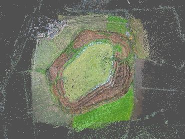
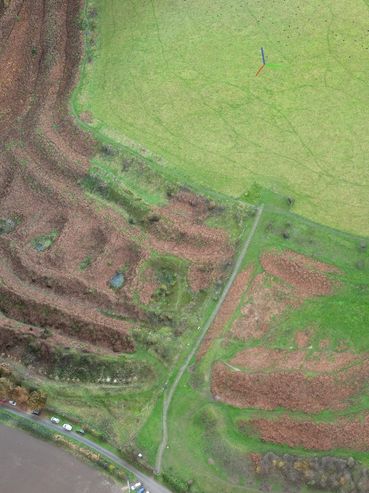
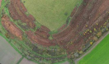
Old Oswestry hillfort is a prehistoric enclosure, constructed in several phases between c.800 BCE and the first century CE. It is one of the largest in England, with a complex set of five ramparts enclosing an internal area of 8.4 hectares. The site was also used for military training during the 1914-18 war.
There is a long-term programme of vegetation management and conservation on the ramparts.
Heritage Innovation was commissioned by English Heritage to undertake aerial survey and photogrammetry.
Scope
The site is is in open countryside but is heavily used by local dog walkers. Although the ramparts are owned by English Heritage, the surrounding land is privately owned. Heritage Innovation used a lightweight drone to undertake aerial photogrammetry from which to create 3D models. Ground control points were deployed to ensure dimensional accuracy.
Two high-level vertical transects (one north-south and one east-west) were made across the site, with three low-level oblique flights to capture elevation detail.
Outcomes
Over 1200 images were used to generate and render an accurately georeferenced 3D model of the whole hillfort. The high resolution model used 5 million polygons, which was downsized for online use.
The full textured model can be seen here: https://skfb.ly/p8IxH
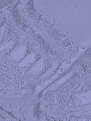
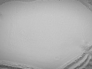
An 'untextured' version, which highlights the First World War training trenches (shown in the monochrome images on this page), can be seen here: https://skfb.ly/p8Ixz
More information and screenshots below.
Site history
There were four phases of construction. The original hillfort comprised a double bank and ditch with entrances at the east and west ends. Later, the west entrance was enlarged - including the addition of the unique and characteristic pits either side of the main gate. Another series of ramparts were then added, and the eastern entrance was also strengthened.
The 1914-18 military training trenches are not visible from the ground but can be clearly seen in the untextured model.
You can read more about the history of the site on the English Heritage website.
Images