Background
Butrint is a Hellenic and Roman city in southern Albania which developed over more than 2,000 years. Described by UNESCO as a 'microcosm of Mediterranean history', Butrint and its surrounding landscape contain important Greek, Roman and medieval remains.
The 200 hectare site is vulnerable to a number of natural risks, including flooding and erosion.
Our work was part of a larger project managed by Abkons to produce a Conservation Management Plan for the Butrint Management Foundation.
Scope
Heritage Innovation undertook the following elements of the Conservation Management Plan:
- Analysis of visitor flow and impact on conservation
- Conservation needs analysis and QA review
- Disaster risk management plan, including analysis of environmental and climate-change impacts
- Photogrammetry and LiDAR survey of selected monuments
We worked closely with a range of Albanian, Italian and UK partners to deliver the project.
Visitor impact analysis
Survey and analysis of visitor flow through the site, on both macro (site-wide) and micro (monument) level. This was based on real-time observation which was mapped against monument vulnerability.
This informed an assessment of the risk for the site and visitors. From this we developed mitigations to improve visitor flow, both for groups and individual visitors. The intention was to enhance the visitor experience and improve conservation outcomes.
Disaster risk analysis
Comprehensive review of the long-term environmental changes which have affected the World Heritage Site, including historic seismic activity which has radically affected water levels and monument stability.
Analysis of future trends resulting both from geological movement and climate change, and its likely impact on the site. Suggested mitigations and priority tasks to enhance safety and interpretation -- informing and embedding long-term approach to disaster risk management in the CMP.
Conservation needs analysis
Reviewing the analysis of conservation needs across the whole archaeological park, with a particular focus on high priority areas. This included a review of historic conservation interventions.
Assessment and analysis of the archaeological and conservation implications of proposed engineering interventions to stablise walls, slopes and vegetation.
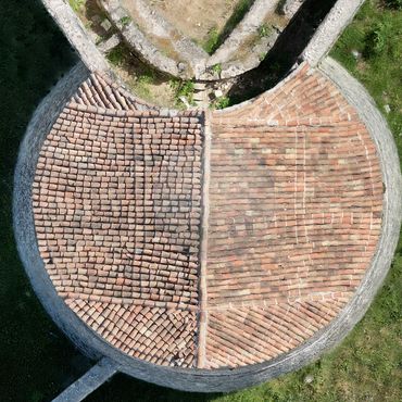
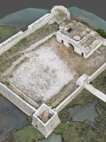
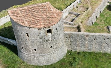
Site survey
We used a combination of aerial photogrammetry and hand-held LiDAR to survey a number of key sites and monuments in the UNESCO complex.
Some of the 3D models included:
- Butrint Archaeological Park: https://skfb.ly/oWOqW
- Ali Pasha's Castle: https://skfb.ly/oWQ6A
- Venetian Triangular Fortress: https://skfb.ly/oWPYK
- Diaporit Roman Villa: https://skfb.ly/oWOtu
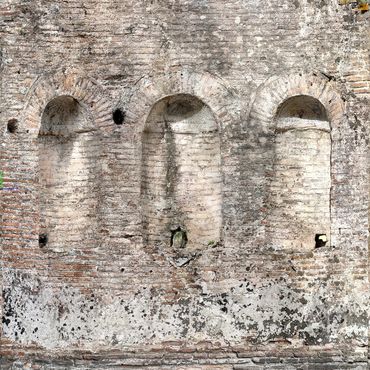
Site history
Established in the early first millennium BCE, Butrint became a Roman colony in 44 BCE. It expanded significantly during that time, with land reclaimed from the marshes on both sides of the Vivari channel. The Romans built a theatre over part of the earlier Greek defensive walls, and later added an aqueduct and bridge to connect with the outlying settlements across the channel.
In the 5th century CE Butrint became an episcopal centre. The site contains a number of important early Christian buildings including a basilica and a baptistery. In the 14th century the site came under Venetian control, and was later part of the Ottoman Empire.
Images