Background
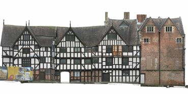
This complex building comprises a late-16th century timber-framed warehouse and a brick mansion of c.1616-18.
Saved from slum clearance in the 1930s, Rowley's House was the town's museum until 2006. Since then it has seen some use as offices, but is now the subject of comprehensive conservation planning to secure its long-term future.
Heritage Innovation was commissioned by Shropshire Council to undertake aerial survey and photogrammetry, and to produce CAD drawings for the conservation architects.
Scope
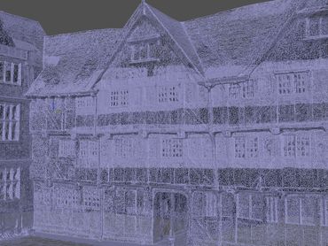
The site is in the busy town centre of Shrewsbury - surrounded by car parks and with a main road on one side, and private houses on the other. Heritage Innovation used a lightweight drone to undertake aerial photogrammetry from which to create 3D models. Ground control points and hand-held LiDAR were also deployed to ensure dimensional accuracy.
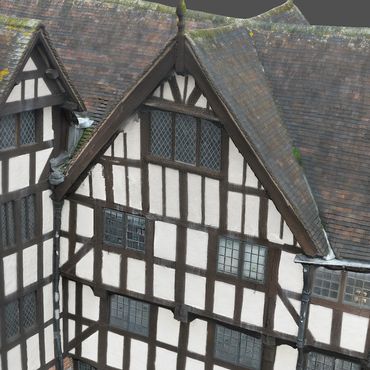
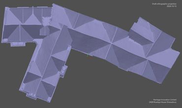
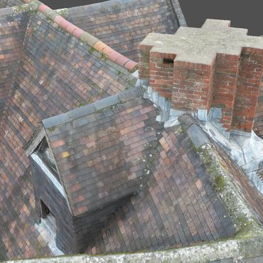
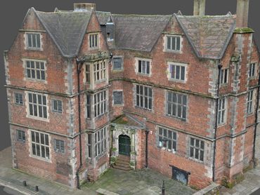
The main focus of the work was the roof structure - but also included the principal external elevations.
Outcomes
Nearly 3000 images were used to generate and render an accurately georeferenced 3D model of the roof and building exterior. This was used to generate orthographic plans and elevations, which in turn were used to produce a CAD drawing of the roof and details.
The 3D model can be viewed here: https://skfb.ly/prUVV
More information about the history of the site, and some additional images, can be found below.
Site history
William Rowley was a wealthy wool merchant and brewer, who built his mansion and warehouse at the height of Shrewsbury's prosperity in the wool trade.
This part of Shrewsbury was a densely-packed area of medieval buildings, lanes and yards. The diverse urban landscape included a number of similar merchants' houses, as well as tanneries and chapels. Most of this area was demolished in the 1930s as ‘slum clearance’ to create a bus station.
Rowley’s House survived, and now stands in isolation.
Images